Users can drop points utilizing the mobile application. Those points are created in the latitude and longitude coordinate system. For our customers who require UTM coordinate systems for regulatory reporting of observations like cultural resources, we have implemented the ability to convert latitude and longitude to UTM during the survey sync (save) process. In addition, for all Cultural Resource Management and Archaeology agency exports we display the converted UTM coordinates.
You can:
- Set Convert to UTM on latitude/longitude questions.
- Set Convert to UTM on photo questions.
If a survey is synced/saved with latitude/longitude or photo questions with the Convert to UTM flag enabled, Wildnote converts the coordinates to UTM and saves the values in our GPS metadata JSON object. Original lat/long coordinates are kept intact.
- All standard exports, as well as survey show and edit display both lat/long and UTM coordinates.
- All agency exports display the converted UTM coordinates.
- In addition, we have added Datum to the GPS metadata display of dropped points and photos recognizing that knowing what datum the data was collected in is very important to some of our users.
A Note About Datum: We’ve successfully implemented a system to project coordinates of any standard datum into UTM, but we are cognizant that the convention for CRM is to use NAD83 Datum for all coordinates. Coordinates coming into Wildnote may already be in NAD83 if captured using a GNSS device, but are more likely to be in WGS84, which is the datum we receive natively from phones and tablets. While NAD83 and WGS84 generally deviate by less than 1-2 meters in the continental US, this error may pose a problem for any work requiring submeter accuracy. However, if submeter accuracy is needed then the customer would probably be using a GNSS device which is highly likely to be in NAD83.
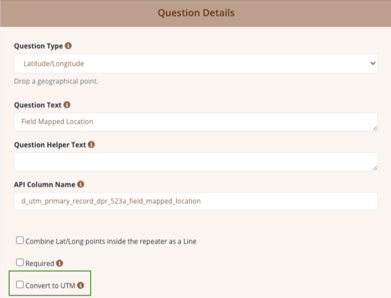
How to Enable the "Convert to UTM" Feature
- Go to the Survey Form template that has the Latitude Longitude or Photo question in it.
- Click Edit on that question in the survey form builder.
- Check the box that says "Convert to UTM".
What to Expect:
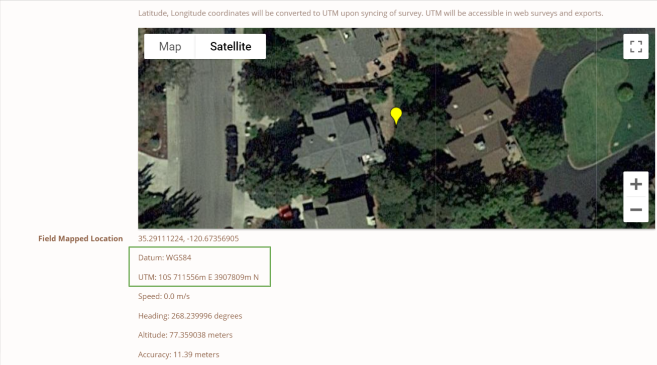
When you drop a pin on your mobile device, upon survey Sync, those coordinates will be converted to UTM on the web. When you review your data on the web, you will see the original coordinates, Datum, and UTM Northing and Easting. Our agency exports will display the UTM automatically. If you are using a survey form that you designed, our standard PDF export and Pivot export will also show the UTM coordinates.
Check out this video for further details: